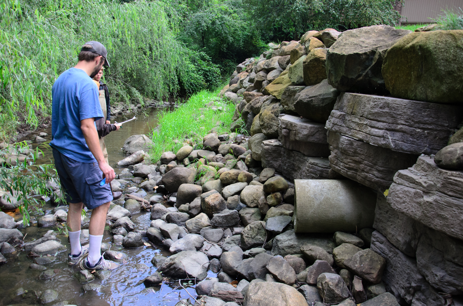
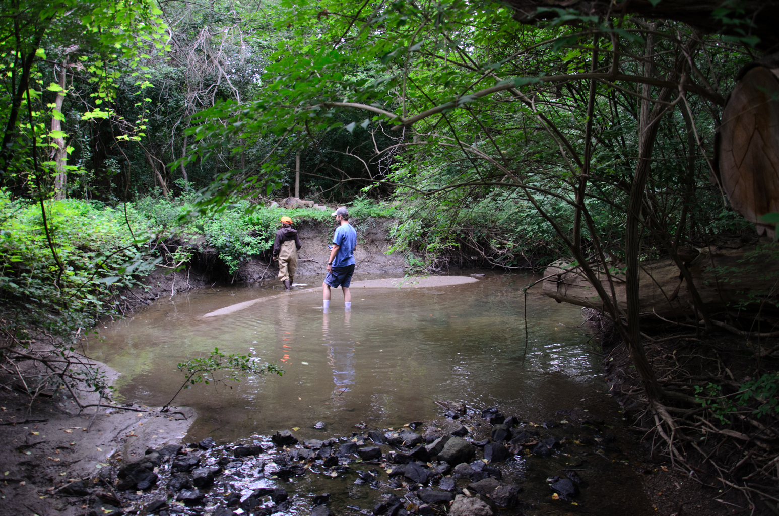
Last night, Hayden and I participated in another volunteer opportunity with the Huron River Watershed Council. Like the Measuring and Mapping, the idea behind these stream walks is to take certain measurements and make certain observations that may be used by watershed professionals to gauge the health of the river and identify potential issues.
Unlike the Measuring and Mapping, during the River Walks we are responsible for a much longer stretch of a tributary. Tonight, our team walked downstream as far as we could from our assigned starting spot, making it about 2/3 of a mile before the creek crossed under a road and into a marshy area. During this walk down this small creek, we wove our way through the twists and turns of the creek, walking through shallow rocky sessions as well as deep pools (we have to stay in the stream so that we do not trespass on private property – rivers, creeks, etc. are public). Much of this creek is bordered and even covered by dense vegetation, making walking the length of the stream really challenging. Our task was to take temperature, depth and other readings in the stream while also taking pictures and recording the GPS coordinates of each measurement location.
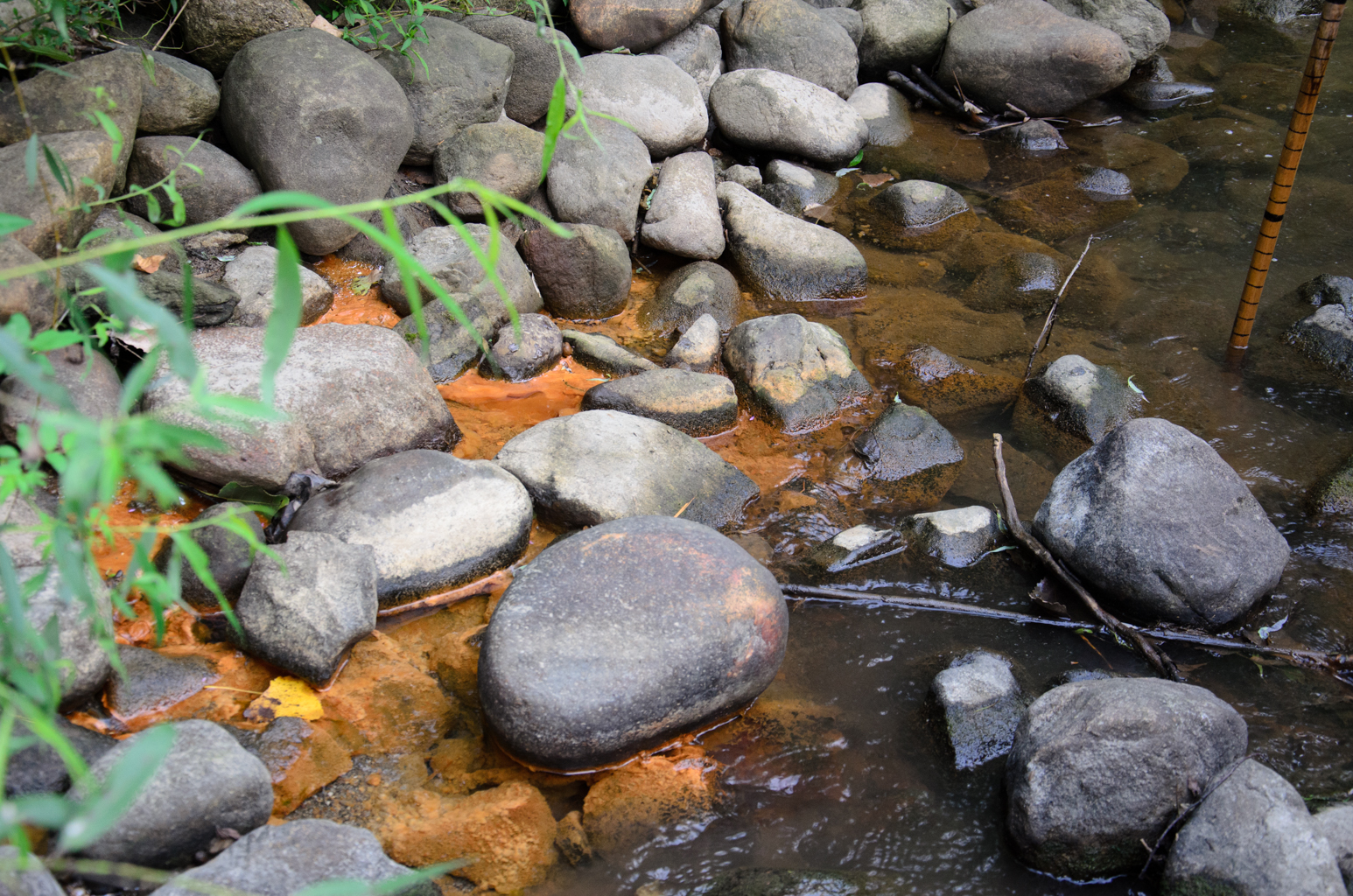
In this setting, we are not tasked with taking measurements at any set interval, but rather as interesting stream characteristics present themselves. This could be natural features like pools, undercut banks, and wildlife. Or it could be impacts from people such as pipes, unnatural banks (retaining walls, lawns, etc), erosion, etc..
This was our second time together as a team, the first being a training walk over a 300′ stretch of the same stream. We did well tonight and we are looking forward to walking a full mile upstream in our next outing.